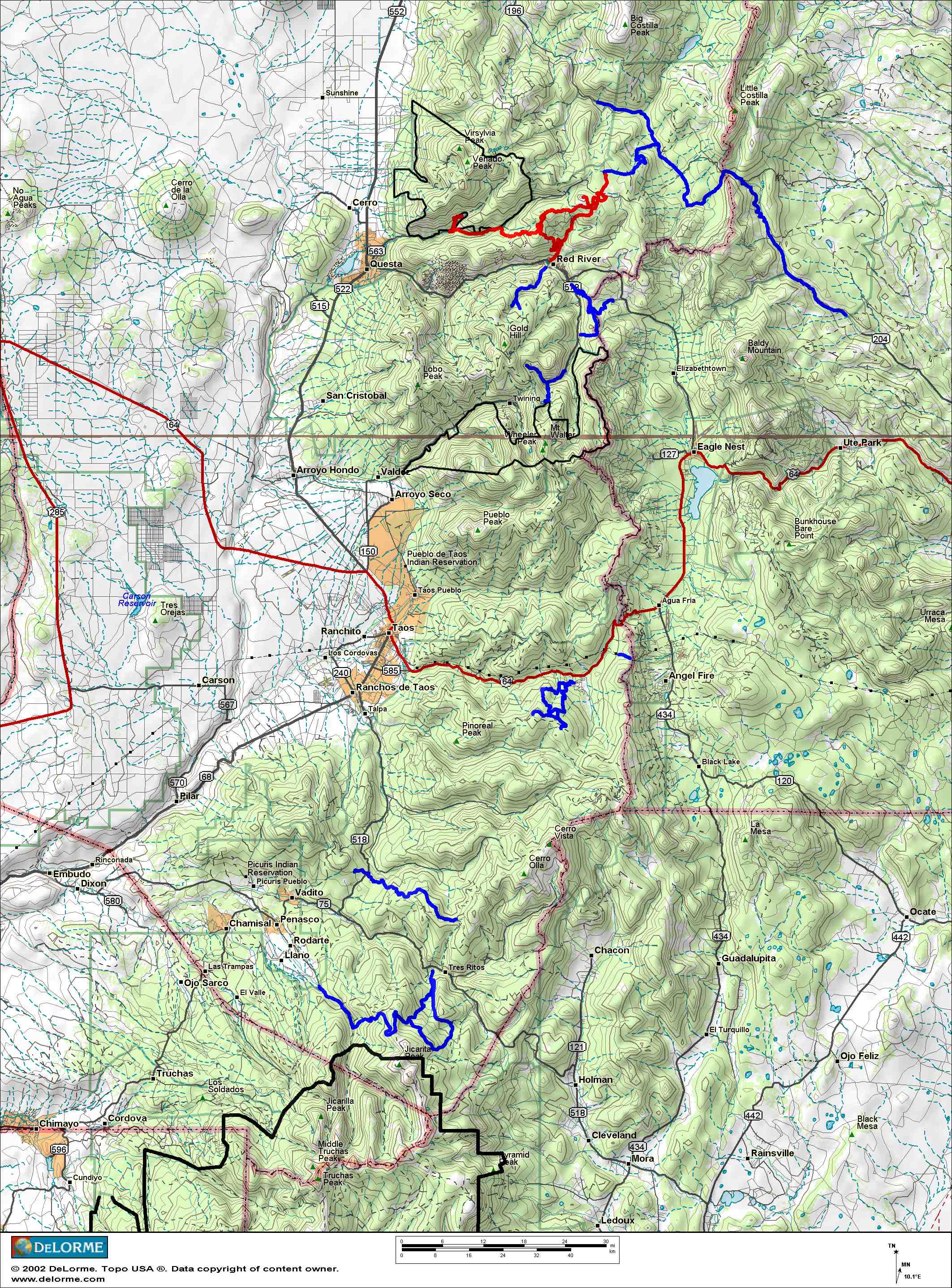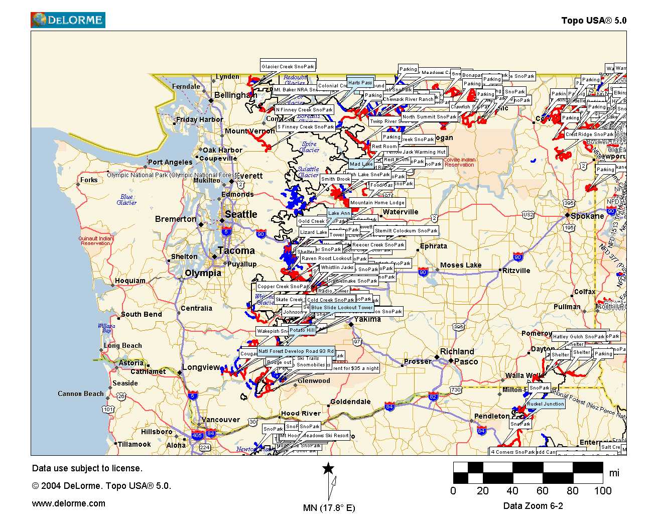
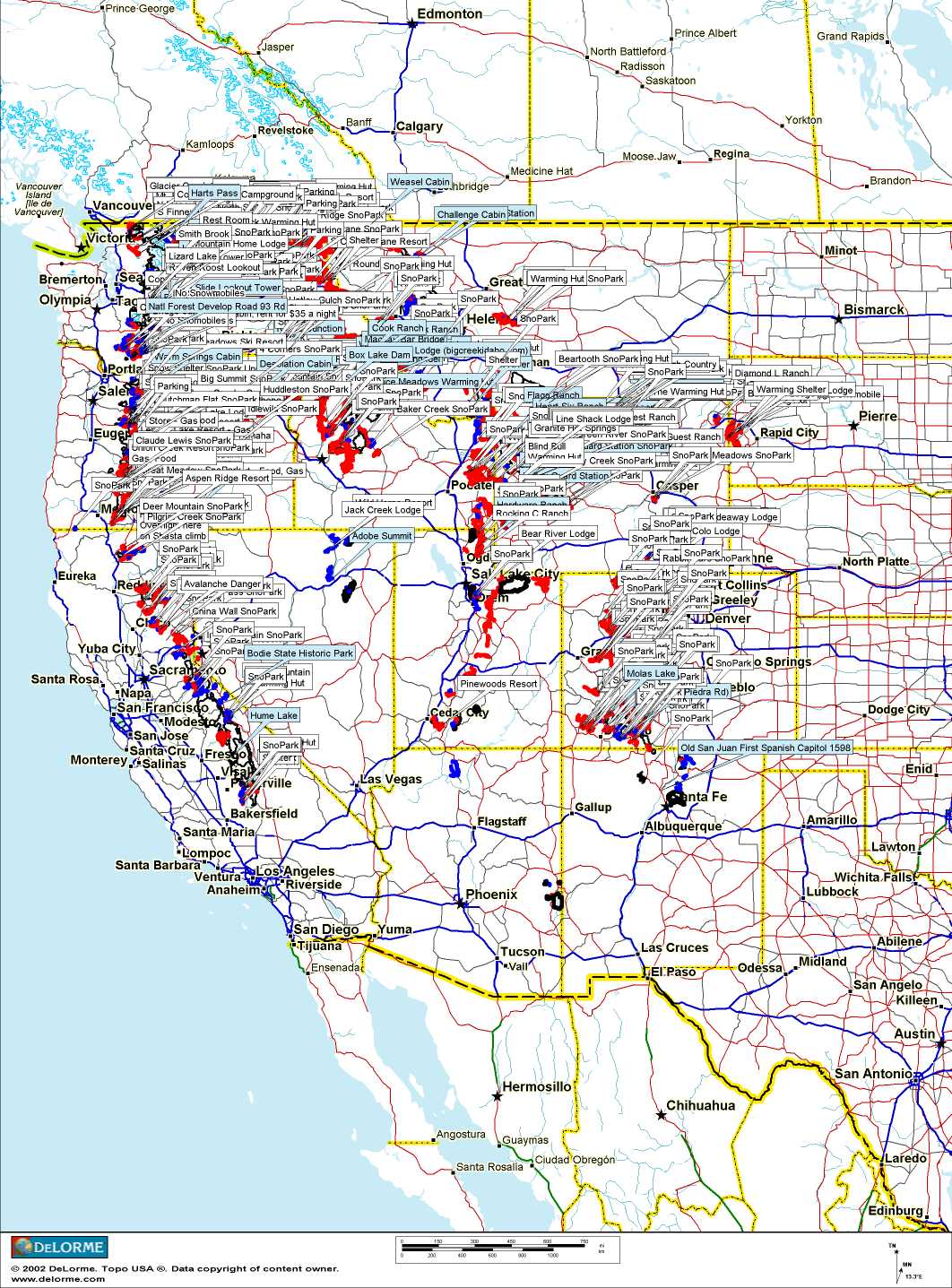
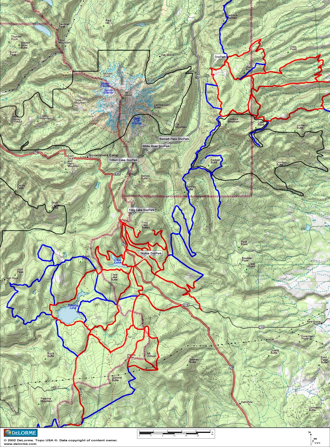
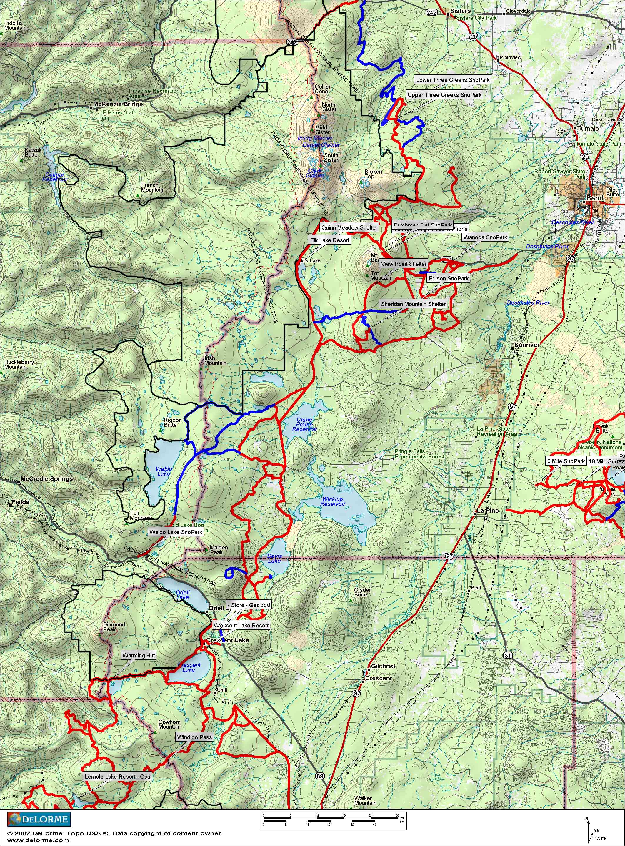
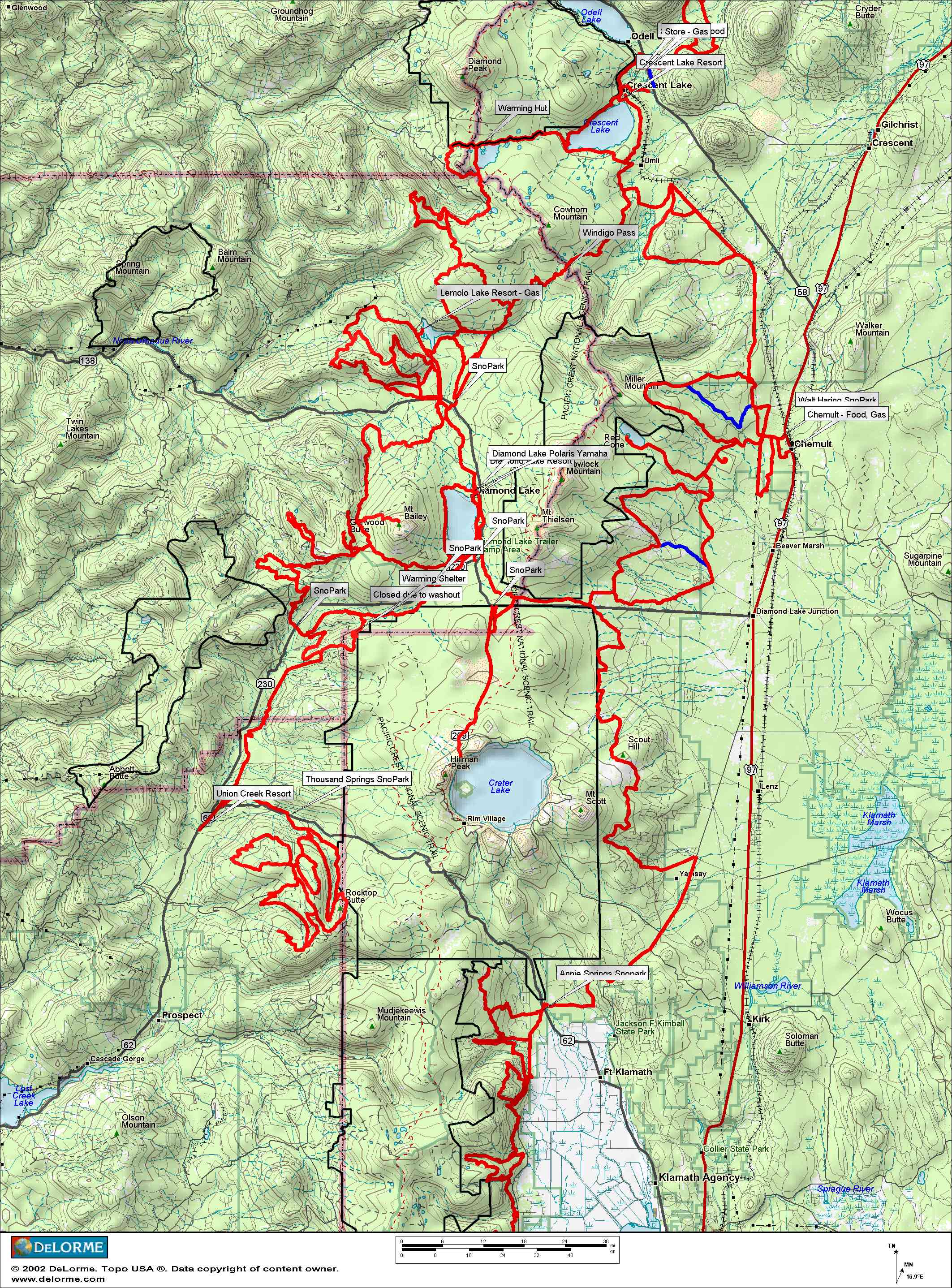
On these maps, red lines are groomed, blue lines un-groomed, and black lines are wilderness areas. I will be posting additional maps, and if you need any others let me know.
If you have Delorme TOPO 3.0, 4.0, or 5.0, you can download the draw files that created these maps and includes snowmobile trails, with SnoParks, shelters, and fuel stops accessible by trail marked for Oregon, Washington, Idaho, Montana, Wyoming, Colorado, Utah, New Mexico, and I have started working on California. These maps are always a work in progress, and I will make changes to the file as I find new areas and trails or see where changes have occurred, so check once in awhile and see if the file has been updated. I am also using my GPS unit to check accuracy of trails and will make changes to map if the trails are not quite where I thought they were, and to add un-groomed routes that are ridable.
I am breaking up the Western US file into individual states for the different versions, so that the files will load faster on your computer. The program gets a little slow with such a huge file. You can load one or all the files in Topo by going to the MapData tab and loading them and then checking or un-checking the boxes under draw files.
Topo 4.0 draw files
Western US - updated 01/26/04
California - coming soon
Colorado - coming soon
Idaho - coming soon
Montana - coming soon
Nevada/Arizona - coming soon
New Mexico - coming soon
Oregon - coming soon
South Dakota - coming soon
Utah - coming soon
Washington - coming soon
Wyoming - coming soon
Topo 5.0 draw files
Western US - coming soon
California - updated 02/23/05
Colorado - updated 02/06/05
Idaho - updated 01/28/05
Montana - updated 01/30/05
Nevada/Arizona - updated 01/29/05
New Mexico - updated 02/16/05, not complete yet
Oregon - updated 01/21/05
South Dakota - coming soon, western edge along Wyoming border is in Wyoming file.
Utah - updated 01/30/05
Washington - updated 01/16/05
Wyoming - updated 02/15/05, includes western edge of South Dakota
Also if you have 4.0 or 5.0 make sure and do the new Delorme Magnetic Declination Update, it is needed to do any updates to the maps and fixes a lot of other things.
The maps below are large files around 1mb and will open up in a new window. After they open, right click on the map and then click save picture as, to save to your hard disk.
Washington coverage 5.0 US coverage 4.0
Mt. Hood area Hiway 12 area, from Morton to Rimrock
![]()
Mt Bachelor to Crescent Lake Crescent Lake to Crater Lake
Taos, New Mexico area